Logo Steav
  • Home
  • Company
    • About us
    • Technologies
  • Services
    • Survey
    • BIM
  • Fields
    • Land and environment
    • Architecture and engineering
    • Construction
    • Historical and artistic heritage
  • Projects
  • Contacts
    • Info and contacts
    • Job opportunities
  • IT
  • EN
  • Search

Land and Environment

LAND AND ENVIRONMENT
Know your own territory to protect the environment

Only having the correct, accurate information makes it possible to make the best choices for managing the world we live in.

This is the principle which inspires us to choose tools and methodologies for land surveying and for digital restitution of natural and urban environment, in order to protect its land and man-made features.
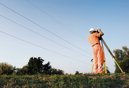
STEAV performs multiscale surveys working with new, multidisciplinary technologies applied to environmental and geomatics engineering. A wide range of services for data collection and analysis, which include and assist territorial surveys, environmental monitoring, urban planning, hydrogeological risk analysis and geographic information systems (GIS).

Some examples of our services dedicated to land and environment:

– Landslide monitoring, regularly measuring the superficial displacement and the extent of the volumes involved and designing digital models for comparison of variations along the longitudinal profiles
– Topographical survey and scanning of glaciers, evaluating the retreat of a glacier foot (terminus) and the reduction of its area, aiming at the formulation of forecasts on the evolution of ice extension
– Quarry surveys for estimating volumes of extraction and environmental impact
– Landfill surveys during operative and post-operative phases, studying morphological settling behaviour
– Path surveys for creating hiking maps and databases
– Sewer system and drainage mapping, identifying wastewater discharges into surface waterways and potential sources of pollution
– Waterway surveys, supporting water management planning and hydrogeological risk prevention and rehabilitation
– Public utilities mapping to create information systems for optimizing plant and land management

Immagine di anteprima Rilievo Topografico

Topographical survey

Laser Scanning immagine di riferimento

Laser Scanning

Gis

Infrastructure Information Modeling

Immagine di anteprima GIS

Geographic Information Systems

ANY QUESTIONS FOR OUR TEAM?

Contact Us

ANY QUESTIONS FOR OUR TEAM?

Contattaci

Subscribe to our Newsletter

  • This field is for validation purposes and should be left unchanged.

Subscribe to our Newsletter

  • This field is for validation purposes and should be left unchanged.

logo STEAV
STEAV Srl – Advanced Territorial Systems: a benchmark for topographic, cartographic and territorial surveying and your perfect professional partner in architectural and engineering design, infrastructure management, urban and territorial planning.

  • Privacy
  • Cookie Policy

SERVICES

  • • Topographical Survey
  • • Architectural Survey
  • • Laser Scanning
  • • Building Information Modeling
  • • Infrastructure Information Modeling
  • • Geographic Information Systems

CONTACTS

  • STEAV Srl via Btg. Val Leogra 38/R
    36100 Vicenza (VI) ITALY
    tel & fax +39 0444 543710
    info@steav.it


© 2005-2019 STEAV Srl Sistemi TErritoriali AVanzati – P.Iva 03223800248

Manage Cookie Consent
To provide the best experiences, we use technologies like cookies to store and/or access device information. Consenting to these technologies will allow us to process data such as browsing behavior or unique IDs on this site. Not consenting or withdrawing consent, may adversely affect certain features and functions.
Functional Always active
The technical storage or access is strictly necessary for the legitimate purpose of enabling the use of a specific service explicitly requested by the subscriber or user, or for the sole purpose of carrying out the transmission of a communication over an electronic communications network.
Preferences
The technical storage or access is necessary for the legitimate purpose of storing preferences that are not requested by the subscriber or user.
Statistics
The technical storage or access that is used exclusively for statistical purposes. The technical storage or access that is used exclusively for anonymous statistical purposes. Without a subpoena, voluntary compliance on the part of your Internet Service Provider, or additional records from a third party, information stored or retrieved for this purpose alone cannot usually be used to identify you.
Marketing
The technical storage or access is required to create user profiles to send advertising, or to track the user on a website or across several websites for similar marketing purposes.
Manage options Manage services Manage {vendor_count} vendors Read more about these purposes
View preferences
{title} {title} {title}