ARCHITECTURAL SURVEY
Architectural survey allows us to know a building or urban work in its entirety, reporting its key features and gathering information for its documentation, study and preservation.
Representing the physical space, the architectural quality and the structural transformations of a work: these are the possibilities and versatility of architectural survey, which is not only a process but also a case study of the best methodologies to be adopted depending on the type of information you want to collect.
- Direct survey
- Instrumental or topographic survey
- Indirect survey (photogrammetry and 3D laser scanning)
Surveying firstly means to understand the work in front of you, to gather all its values, either the dimensional or the constructive ones, both the formal and the cultural ones.
(M. Docci – D. Maestri, Manuale di rilevamento architettonico e urbano, Laterza, Bari, 2009)
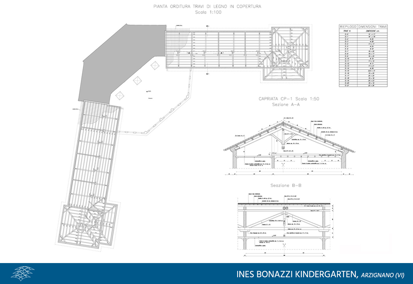
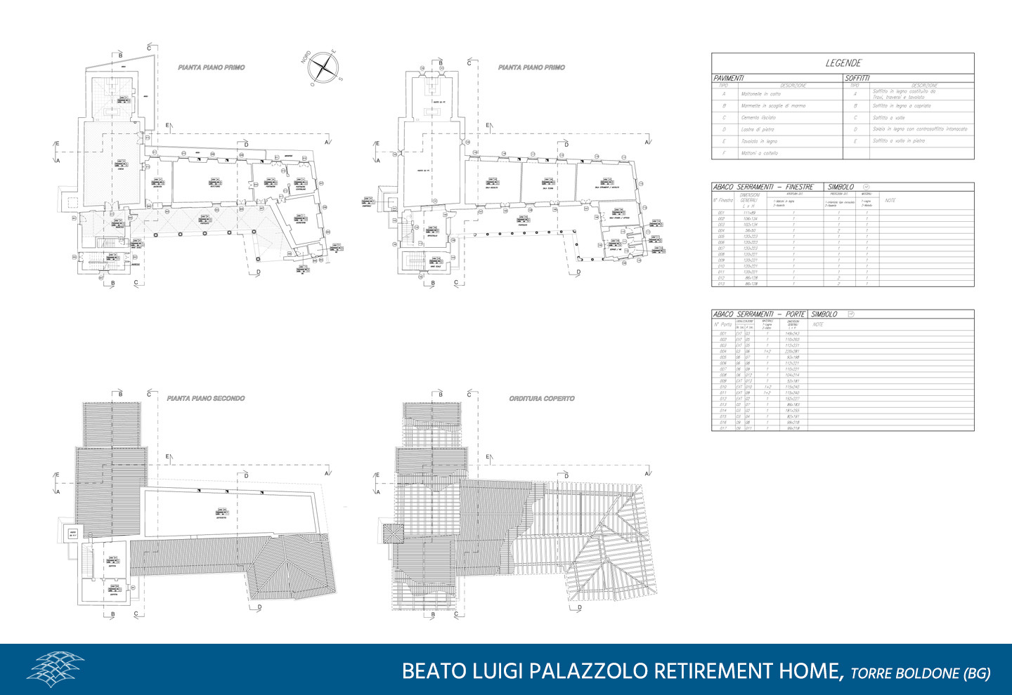
Technological and structural survey of civil and industrial sites
We aim at understanding and graphical representation of the construction details of a site, surveying either the building materials or the construction methods of brickwork, slab floors and plants.
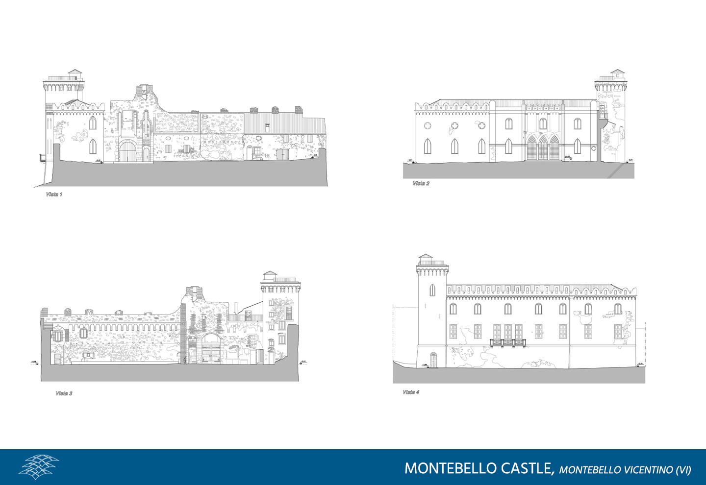
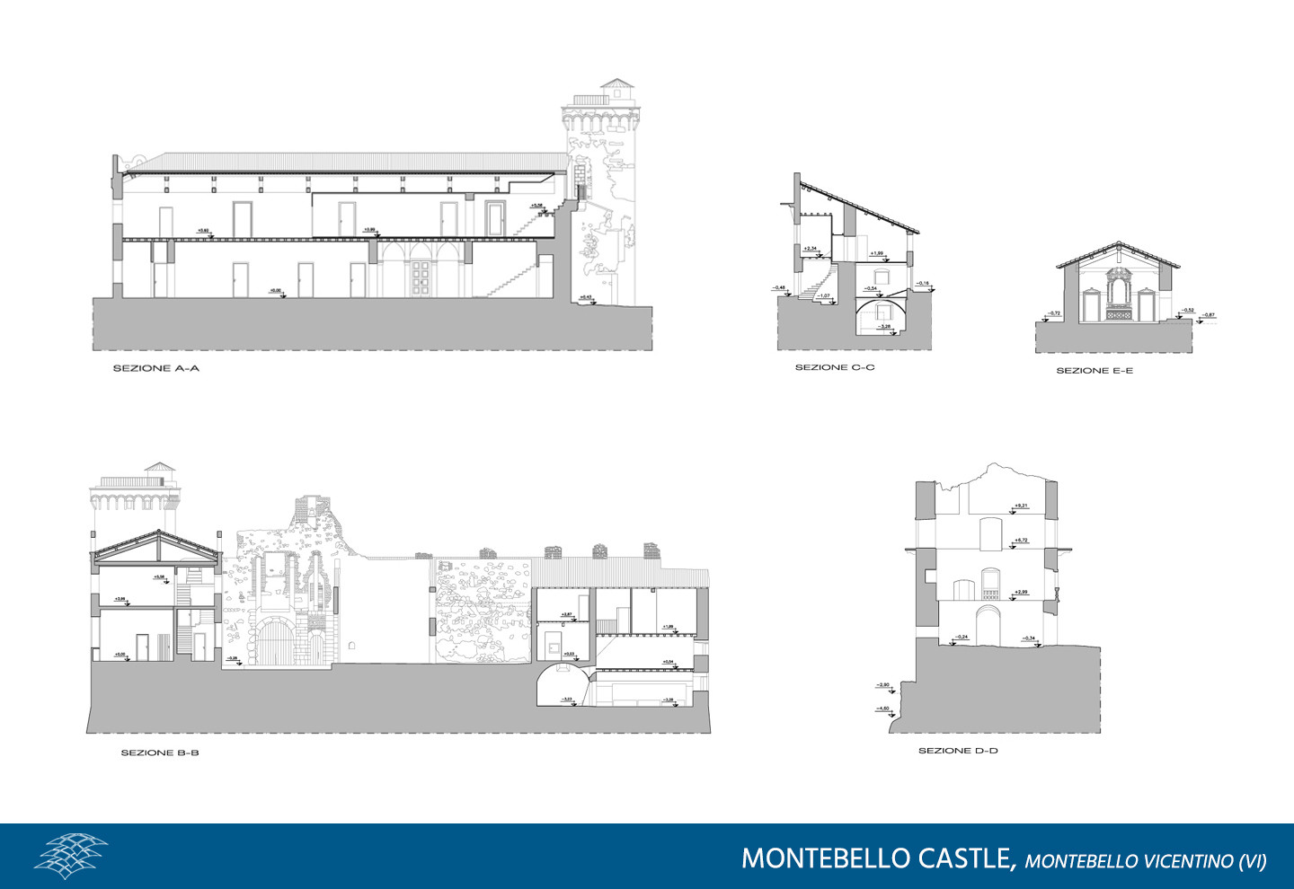
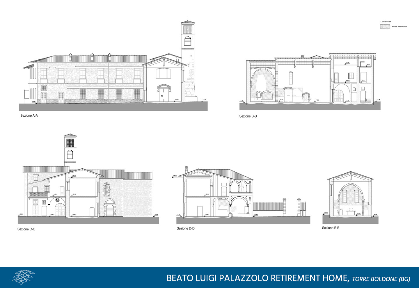
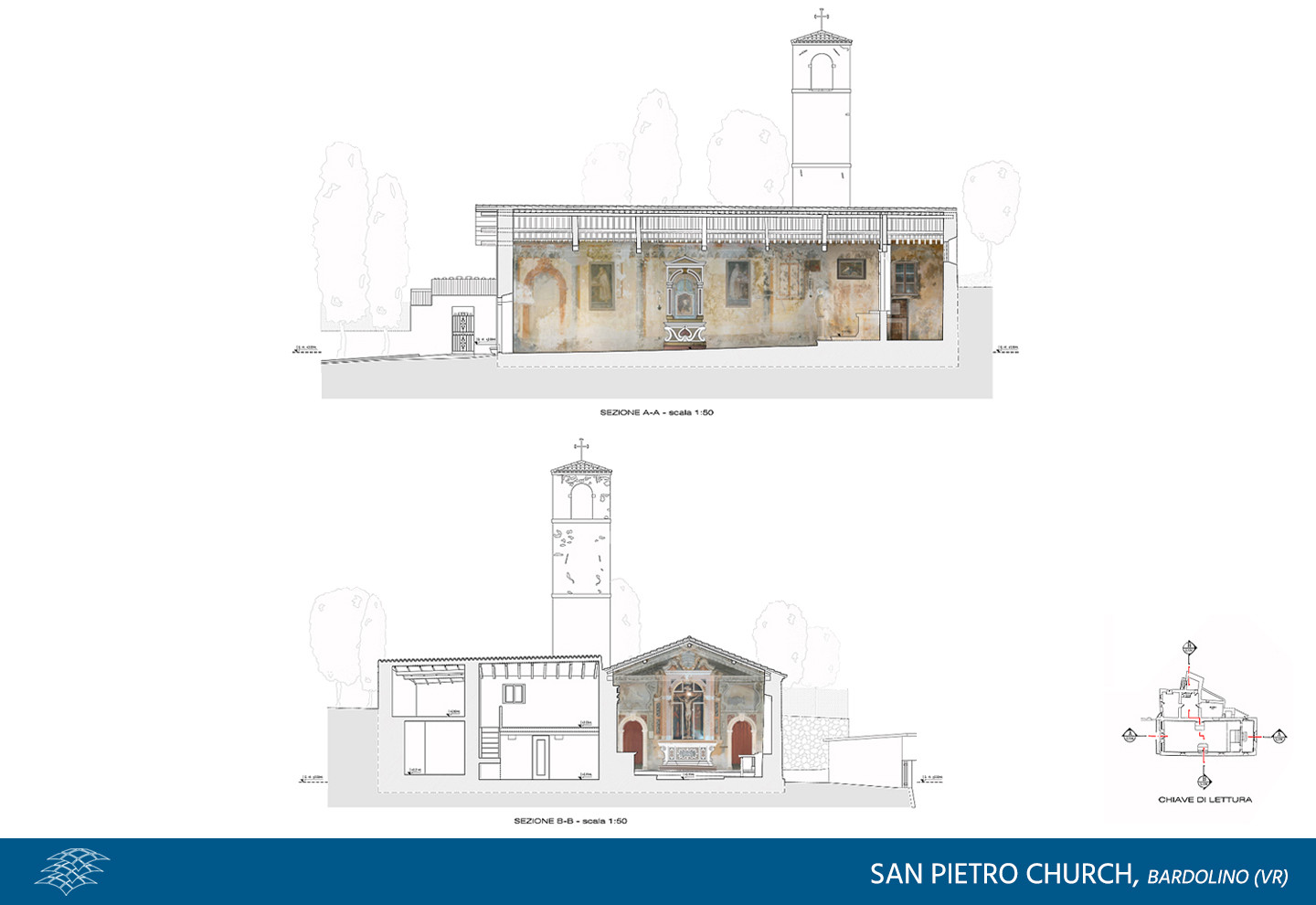
Survey of the historical, artistic and monumental heritage
A distinctive feature of the architectural survey is aimed at preservation of buildings and monuments of historical and artistic value. In fact, it is a critical surveying tool and prior analysis in the restoration planning, helping designers in their procedural evaluations. Thanks to the integration of surveying techniques, it is possible to get an overall systematic description of the cracks occurred and the state of decay, both referring to the surface and to the structural conditions.


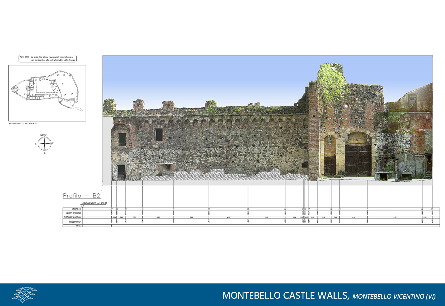
Rectified image plans
We combine instrumental surveys with digital photographic survey and, processing the survey data in true-to-scale rectification software, we provide versatile image plans connecting photographic documentation of existing conditions with the exact geometric information. Moreover, by calculating the 3D coordinates of the object, we can use it in CAD.

Related projects
Sandrigo Hospital – ULSS 6 Vicenza
Architectural surveying, building inventory and modeling of the Multipurpose Service Centre at…