Rehabilitation of Nelson Mandela Road – Tanzania
Field survey for the rehabilitation of Nelson Mandela Road in Dar Es Salaam
Project data
Dar Es Salaam | Republic of Tanzania
6°49’56.9″S 39°14’23.2″E
2007-2009
Client: G. MALTAURO Constructions | Vicenza (Italy)
General Contractor: Tanzania National Roads Agency (TANROADS)
Execution Plan: Carl Bro AS / Consulting Engineers and Planners | Glostrup (Denmark)
Executive Company: MALTAURO-SPENCON-STIRLING JV Ltd
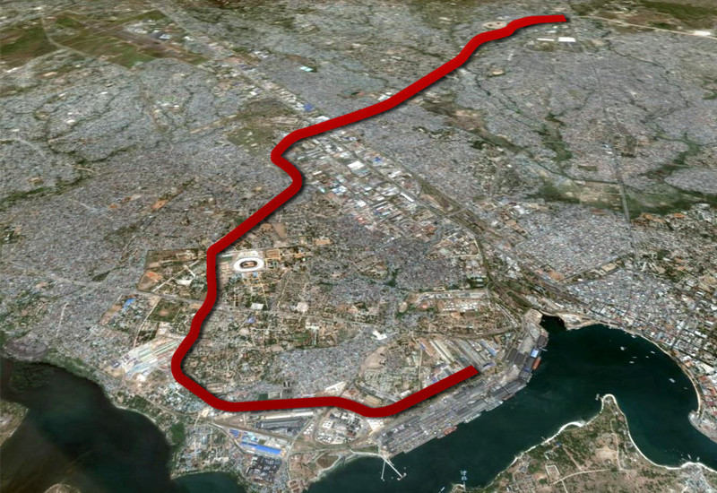
Development of a topographic survey of the road alignment between the town of Ubungo and Marine Port for a total length of about 16 km.
Sequence of major surveying operations we carried out:
- Network densification of benchmarks
- Implementation of a closed levelling line on set benchmarks
- Setting of the centre line and surveying of the roadway in sections, including intersections and civil works
- Design and development of the execution plan
Project overview
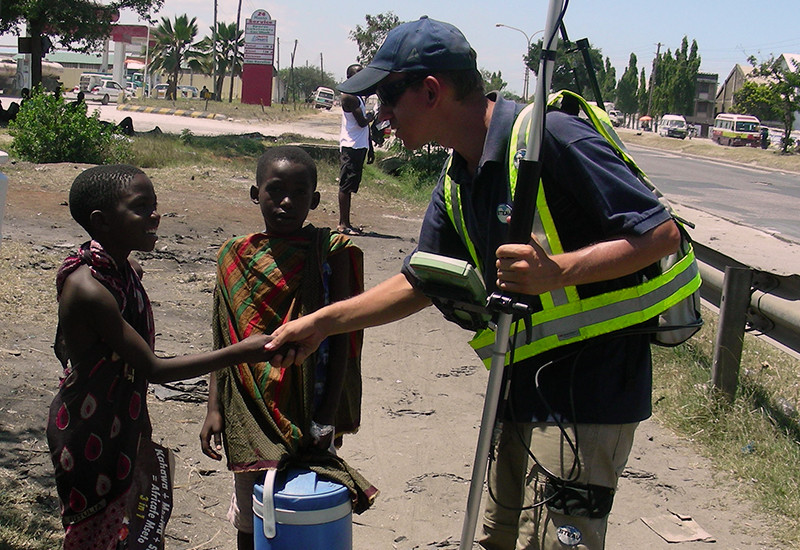
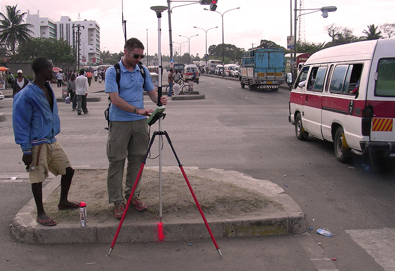
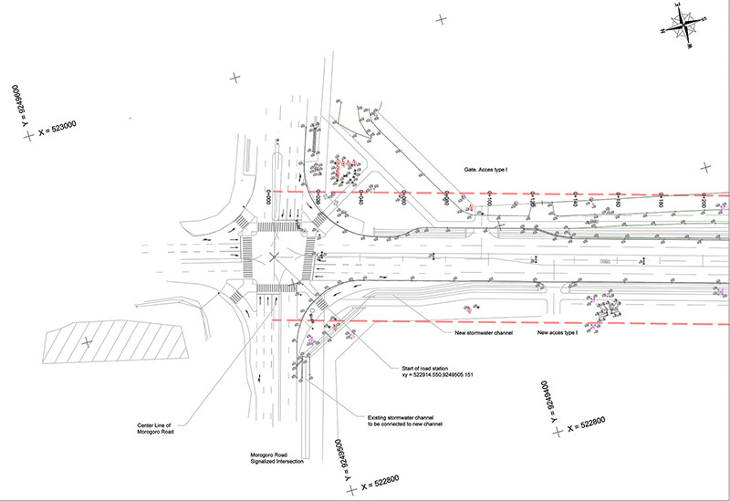
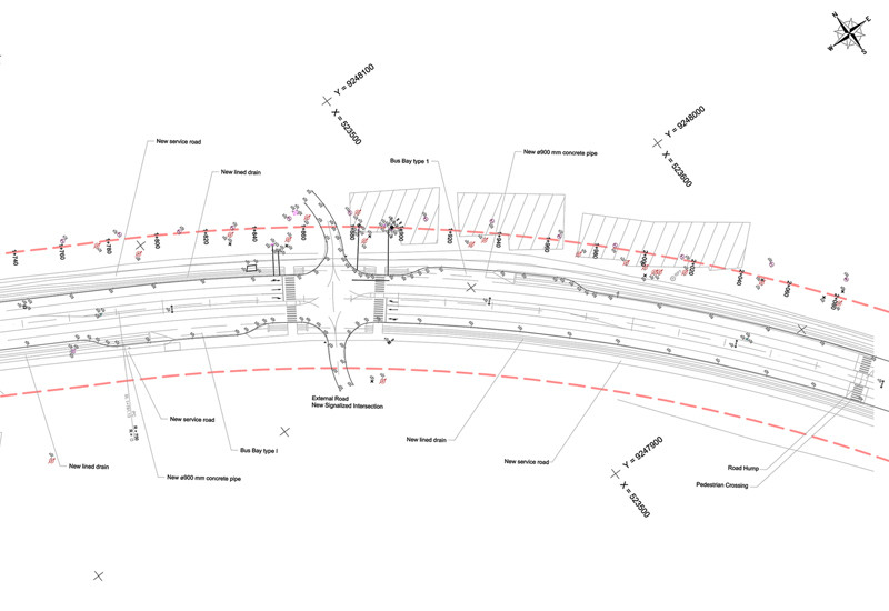
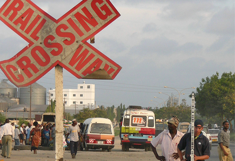
Our field survey in Dar Es Salaam (Republic of Tanzania) concerned the urban road section of Mandela Road, one of the main arterial thoroughfares between the urban area of Ubungo and the commercial area of Marine Port, for a total length of about 16 km.
The main project involved rehabilitation works on the existing thoroughfare, that can be summed up in 2 steps:
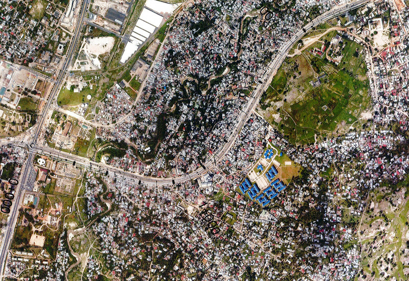
- Rebuilding of the main road in its 2 two-lane carriageways, including the restoration of all central and lateral curbs along the entire street; reconstruction of the road junctions at crossroads and side roads; vertical realignment of the road near railway crossings and causeways; reconstruction and recovery of the stormwater draining ditch between the main road and the side roads
- Building of a coplanar road for each of the ways for a total length of the project and construction of a new stormwater draining ditch between the existing road and the new service roads
Our service
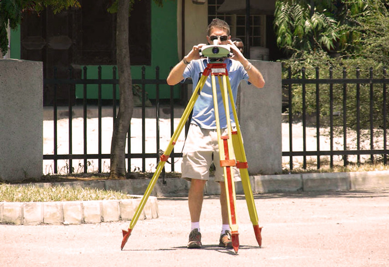
The sequence of the surveying operations was the following:
- Monitoring and verification of the existing benchmarks; densification of the network with new benchmarks
- Determination and calculation of the closed levelling line on the set benchmarks
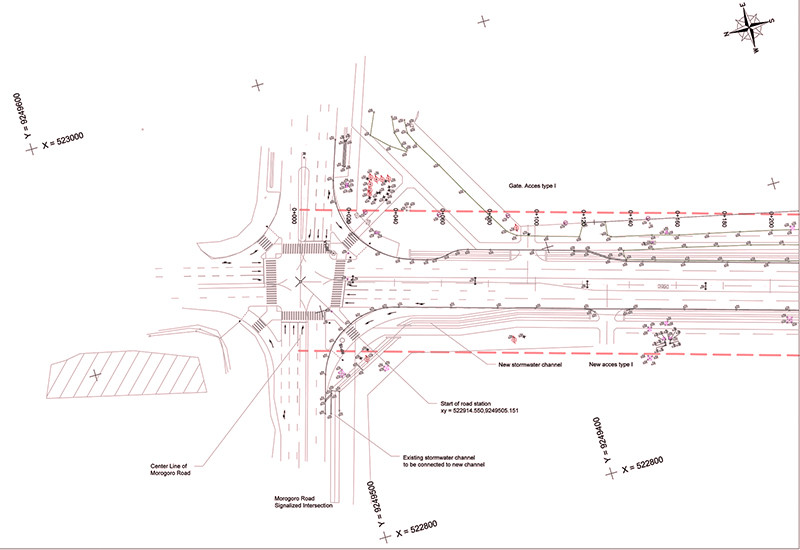
- Setting of the centre line and consequent surveying of ground and roadway in sections, including bridges, railway crossings and other civil works
- Drawing of plans, longitudinal profiles and sections for the subsequent estimate of earth moving needs and the control of the execution plan


Project data
Dar Es Salaam | Republic of Tanzania
6°49’56.9″S 39°14’23.2″E
2007-2009
Client: G. MALTAURO Constructions | Vicenza (Italy)
General Contractor: Tanzania National Roads Agency (TANROADS)
Execution Plan: Carl Bro AS / Consulting Engineers and Planners | Glostrup (Denmark)
Executive Company: MALTAURO-SPENCON-STIRLING JV Ltd
Development of a topographic survey of the road alignment between the town of Ubungo and Marine Port for a total length of about 16 km.
Sequence of major surveying operations we carried out:
- Network densification of benchmarks
- Implementation of a closed levelling line on set benchmarks
- Setting of the centre line and surveying of the roadway in sections, including intersections and civil works
- Design and development of the execution plan
Project overview
Our field survey in Dar Es Salaam (Republic of Tanzania) concerned the urban road section of Mandela Road, one of the main arterial thoroughfares between the urban area of Ubungo and the commercial area of Marine Port, for a total length of about 16 km.
The main project involved rehabilitation works on the existing thoroughfare, that can be summed up in 2 steps:
- Rebuilding of the main road in its 2 two-lane carriageways, including the restoration of all central and lateral curbs along the entire street; reconstruction of the road junctions at crossroads and side roads; vertical realignment of the road near railway crossings and causeways; reconstruction and recovery of the stormwater draining ditch between the main road and the side roads
- Building of a coplanar road for each of the ways for a total length of the project and construction of a new stormwater draining ditch between the existing road and the new service roads
Our service
The sequence of the surveying operations was the following:
- Monitoring and verification of the existing benchmarks; densification of the network with new benchmarks
- Determination and calculation of the closed levelling line on the set benchmarks
- Setting of the centre line and consequent surveying of ground and roadway in sections, including bridges, railway crossings and other civil works
- Drawing of plans, longitudinal profiles and sections for the subsequent estimate of earth moving needs and the control of the execution plan