Cable-stayed bridge A31 Highway - South Valdastico
Topographic monitoring service of the new viaduct over the river Bacchiglione
Project data
Longare – Montegalda | Vicenza (Italy)
45°27’42.2″N 11°37’54.2″E
2010-2011
Client: CIMOLAI Ltd | Pordenone (Italy)
General Contractor: Serenissima Costruzioni Ltd | Verona (Italy)
Lot 3 Construction Site – A31 Highway
Topographic monitoring service for the implementation control and verification of the correct positioning during all phases of assembly and fixing of the structural steel elements constituting the main warping of the new cable-stayed bridge over the river Bacchiglione on the A31 Highway
Project overview
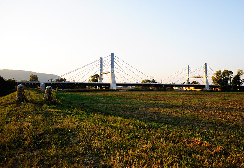
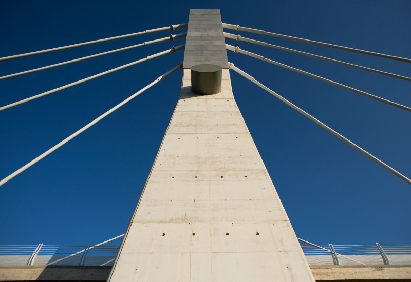
One of the most important infrastructures of the new A31 Highway, known as South Valdastico, is the viaduct over the river Bacchiglione between the municipalities of Longare and Montegalda (within the province of Vicenza).
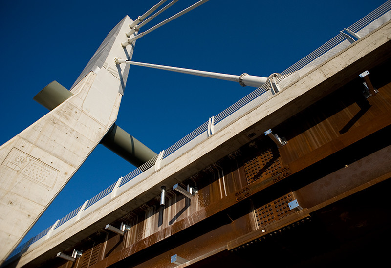
The design for the crossing of the river Bacchiglione and the ditch Canaletto involved the construction of a nine-span viaduct, three of these spans constituting a 532 meter long cable-stayed bridge with a single 35,5 meter wide deck, including the anchoring side bands, supported by two 40 meters high pillars, 140 meters far from each other.
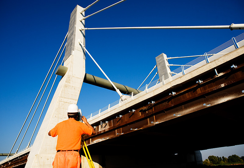
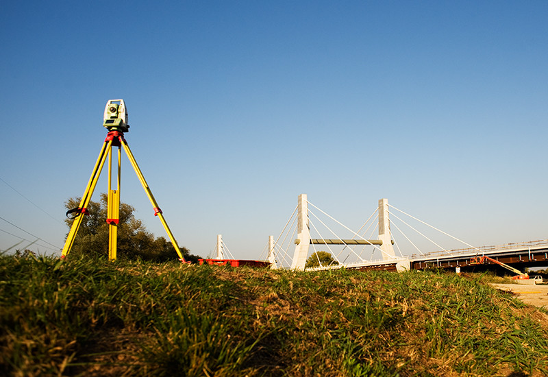
The main structure, made of steel and concrete, was made in its structural steel elements by CIMOLAI Ltd, based in Pordenone, that commissioned us the topographic monitoring service for the implementation control and verification of the correct positioning during all phases of assembly and fixing of the bridge.
The total costs for the construction of the viaduct, begun by Serenissima Costructions Ltd in February 2009 with the opening of the construction site Lot 3 of South Valdastico, were approximately € 49 million. The completion of the work and the debut of this new South Valdastico section, extending from the interconnection between A4 and A31 at the East side of Vicenza to the exit at Montegaldella – Longare was inaugurated on September 22, 2012.
Our service
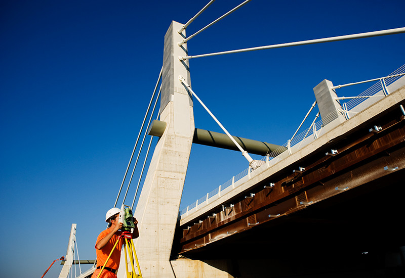
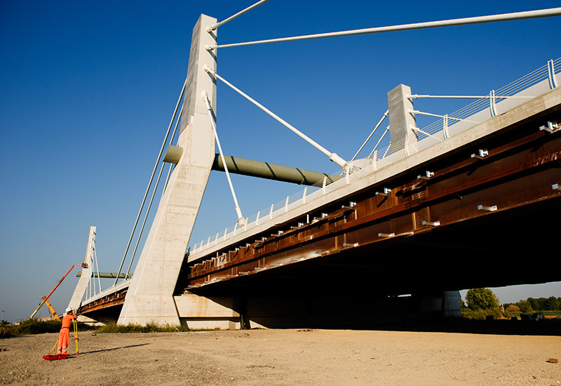
Our work developed through the initial drawing of a precision closed polygon for the surveying of the reference cornerstones in order to determine the local absolute coordinate system. The latter, also called bridge system, combined with the reference system of the executive design, identified by the theoretical coordinates, would then allow us to control the deviations in X, Y and Z of each structural element in the assembly phase, with respect to its corresponding position within the project.
After this first phase, we proceeded with marking reference targets in correspondence to pre-known points, directly in the structural elements related to the main girders of the bridge. Comparing the surveyed coordinates with the project ones, we checked and correctly positioned each segment constituting the main warping of the bridge deck. Once the guys of the pillars were connected, we checked the correct values of tensioning of the entire structure.


Project data
Longare – Montegalda | Vicenza (Italy)
45°27’42.2″N 11°37’54.2″E
2010-2011
Client: CIMOLAI Ltd | Pordenone (Italy)
General Contractor: Serenissima Costruzioni Ltd | Verona (Italy)
Lot 3 Construction Site – A31 Highway
Topographic monitoring service for the implementation control and verification of the correct positioning during all phases of assembly and fixing of the structural steel elements constituting the main warping of the new cable-stayed bridge over the river Bacchiglione on the A31 Highway
Project overview
One of the most important infrastructures of the new A31 Highway, known as South Valdastico, is the viaduct over the river Bacchiglione between the municipalities of Longare and Montegalda (within the province of Vicenza).
The design for the crossing of the river Bacchiglione and the ditch Canaletto involved the construction of a nine-span viaduct, three of these spans constituting a 532 meter long cable-stayed bridge with a single 35,5 meter wide deck, including the anchoring side bands, supported by two 40 meters high pillars, 140 meters far from each other.
The main structure, made of steel and concrete, was made in its structural steel elements by CIMOLAI Ltd, based in Pordenone, that commissioned us the topographic monitoring service for the implementation control and verification of the correct positioning during all phases of assembly and fixing of the bridge.
The total costs for the construction of the viaduct, begun by Serenissima Costructions Ltd in February 2009 with the opening of the construction site Lot 3 of South Valdastico, were approximately € 49 million. The completion of the work and the debut of this new South Valdastico section, extending from the interconnection between A4 and A31 at the East side of Vicenza to the exit at Montegaldella – Longare was inaugurated on September 22, 2012.
Our service
Our work developed through the initial drawing of a precision closed polygon for the surveying of the reference cornerstones in order to determine the local absolute coordinate system. The latter, also called bridge system, combined with the reference system of the executive design, identified by the theoretical coordinates, would then allow us to control the deviations in X, Y and Z of each structural element in the assembly phase, with respect to its corresponding position within the project.
After this first phase, we proceeded with marking reference targets in correspondence to pre-known points, directly in the structural elements related to the main girders of the bridge. Comparing the surveyed coordinates with the project ones, we checked and correctly positioned each segment constituting the main warping of the bridge deck. Once the guys of the pillars were connected, we checked the correct values of tensioning of the entire structure.